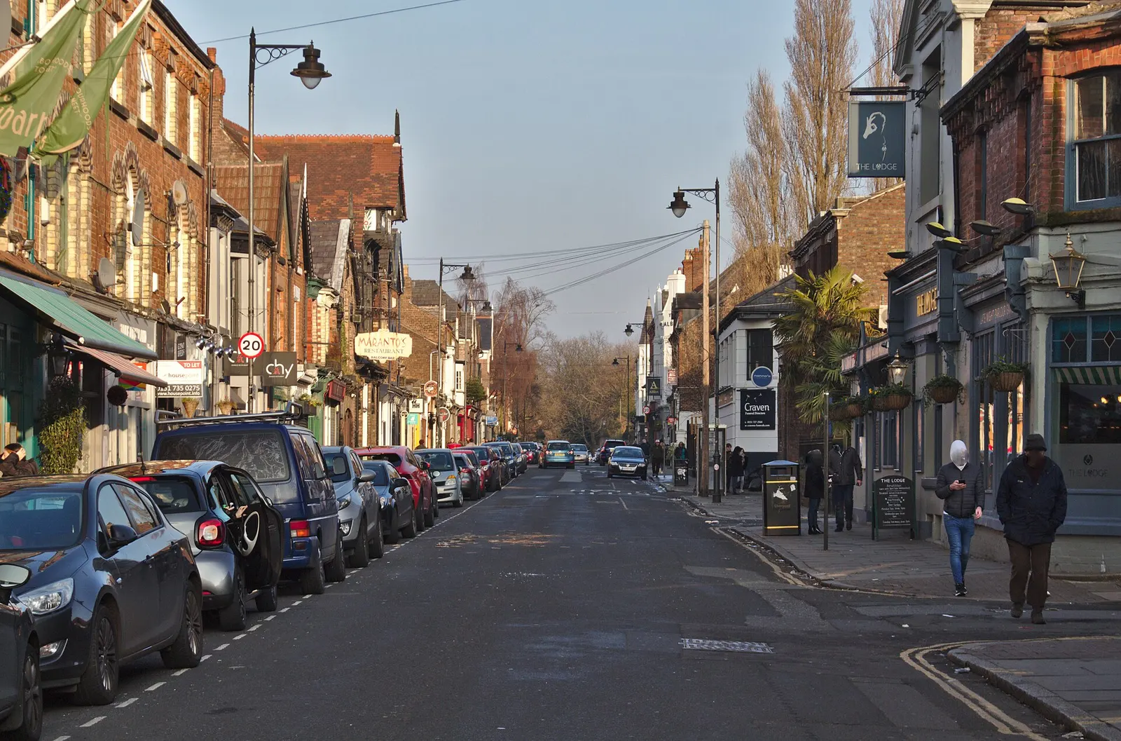
Aigburth is one of Liverpool’s easiest areas to recognise and one of the hardest to define precisely. The name is used for a broad part of south Liverpool between Sefton Park and the Mersey, stretching along Aigburth Road towards Grassendale and overlapping in everyday conversation with St Michael’s, Lark Lane and parts of Mossley Hill.
Lark Lane gets most of the attention, but Aigburth is not one food street beside a park. It is a residential area organised around a long main road, two Northern Line stations, schools, sports grounds, older terraces, larger Victorian houses and access to both Sefton Park and the river.
Liverpool now has an Aigburth electoral ward, but the neighbourhood people call Aigburth extends beyond any single council boundary. That is why addresses described as Aigburth can appear in L17, L18 and L19.
Aigburth Road is the practical centre
Aigburth Road carries buses, shops, cafés, supermarkets, pubs, schools and most of the area’s day-to-day movement. It changes character as it runs south. Around Lark Lane and St Michael’s it is denser and easier to walk. Further towards Aigburth Vale and Grassendale, larger roads, family housing and retail sites become more prominent.
The road is more useful than glamorous. That is precisely why it matters. Independent businesses sit beside national chains, pharmacies, grocers, takeaways and services people need through the week. New openings have brought more cafés, creative shops and food businesses onto the road, but long-standing everyday shops remain just as important to the area.
Lark Lane runs between Aigburth Road and Sefton Park. It has one of Liverpool’s strongest concentrations of independent cafés, restaurants, bars and small shops. It can become very busy on warm weekends and market days, and residential streets around it are not designed to absorb unlimited visitor parking.
The council’s Lark Lane Market normally uses the space by the Old Police Station at the Aigburth Road end. Dates change, so check the official market listing rather than assuming it takes place every weekend.
Parks, the river and sport
Sefton Park forms Aigburth’s northern green edge. The council describes it as a 235-acre Grade I registered park. Its lake, Palm House, paths and open fields make it useful for everyday exercise as well as large events.
The area’s other direction is towards the Mersey. Otterspool Park runs from Aigburth Road to the river and contains football pitches, adventure golf, children’s playgrounds, skateparks and go-karting, plus a bar and restaurant. Otterspool Promenade provides a long walking and cycling route with views across to the Wirral, connecting north towards the docks and south towards Liverpool Cricket Club and Grassendale. The riverside can be exposed in poor weather, and the distance back to Aigburth Road is greater than a map sometimes suggests.
Liverpool City Council’s Waterfront Strategy proposes reopening Otter’s Pool as a tidal inlet, with improvements to the Merseyfront Walkway including tree planting and segregated pedestrian and cycle routes. These are proposals only. No funding has been confirmed and no timetable has been published.
Liverpool Cricket Club has occupied its Aigburth ground since 1881. Historic England listed its main pavilion at Grade II in 2023, recognising the ground’s cricket, football, rugby and tennis history. It is an important reminder that Aigburth’s sporting life extends beyond running around Sefton Park.
International Festival Gardens and the newer Southern Grasslands sit near the river at the northern end of the wider Aigburth area. Southern Grasslands was created through remediation of previously contaminated land and provides another large public space beside the Mersey.
Getting around Aigburth
Aigburth has better public transport than many outer Liverpool neighbourhoods, but the correct station still depends on the address.
St Michaels station is the usual rail stop for Lark Lane, the western edge of Sefton Park and St Michael’s Hamlet. Aigburth station is further south and better for Aigburth Vale, Liverpool Cricket Club and nearby residential streets. Both are on Merseyrail’s Northern Line towards Liverpool Central and Hunts Cross.
Merseyrail currently gives Aigburth station a step-free access rating of C, meaning it should not be assumed to offer step-free access to every platform. Its station page should be checked by anyone who needs an accessible route. The small station car park closed for 12 months from Monday 16 June 2025 while lifts are installed, so it may be reopening around now. Merseyrail points drivers to Cressington, Brunswick and Liverpool South Parkway in the meantime. Check the station page before planning around a space there.
Frequent buses use Aigburth Road. Routes 82 and 82A run from Aigburth Station to Liverpool One Bus Station in about 30 minutes and also connect to Liverpool John Lennon Airport. The 60, 600 and 800 serve the area too. Current times are best checked through Merseytravel.
Cycling is practical along the river and on some connecting routes. Aigburth Road itself is busy and can feel very different from the traffic-free promenade.
Housing and living in Aigburth
Aigburth contains Victorian and Edwardian terraces, converted flats, larger villas, post-war housing and newer apartment developments. Streets close to Sefton Park and the river can command higher prices, but conditions change quickly between one pocket and the next.
The overall average house price in Aigburth over the last year was £292,144, with terraced properties averaging £282,767 and semi-detached £372,157. The average monthly rent is around £943. Prices vary significantly by postcode: L17, L18 and L19 each have different averages. For a fuller breakdown, see the Aigburth neighbourhood guide.
The area attracts families, graduates remaining in Liverpool and people who want access to parks without losing city-centre connections. That popularity creates pressure as well as demand. Parking, private rents, house conversions and the loss of ordinary shops to more visitor-focused uses can all become local issues.
Anyone considering a move should visit the exact street at different times rather than buying an image of “Aigburth”. Living near Lark Lane is different from living beside Aigburth Vale, and a flat overlooking Aigburth Road has different noise and parking conditions from a house closer to the river.
Sudley House
Sudley House on Mossley Hill Road is a museum managed by National Museums Liverpool. It was built in the early 1800s and later bought by Victorian ship owner and merchant George Holt, who installed his art collection there. When Holt's daughter Emma died in 1944, the house and collection were bequeathed to Liverpool. It holds the only Victorian merchant's art collection still displayed in its original domestic setting.
Festival Gardens housing plans
The largest nearby development question is the future housing scheme beside Festival Gardens. In September 2025, Liverpool City Council announced an expected late-2026 planning application for a first phase of 440 homes, including 80 extra-care and 110 affordable homes. The wider proposal could eventually provide up to 800 homes.
Those figures describe a proposal, not completed or fully approved housing. The planning application, consultation, infrastructure and delivery timetable remain important. The scheme could bring new homes and investment, but it will also raise questions about traffic, public transport, school and health capacity, affordability and protection of the public gardens and riverfront.
What Aigburth is like now
Aigburth works because several versions of south Liverpool sit close together. Lark Lane supports an evening out. Aigburth Road handles ordinary errands. Sefton Park and Otterspool provide two very different kinds of outdoor space. The rail line makes the centre accessible without a car.
The mistake is presenting all of that as one polished lifestyle district. Aigburth remains a working residential area with busy roads, parking pressure, uneven pavements, school traffic and neighbourhood services alongside the parts that appear in weekend guides.
Nearby areas
Toxteth and the Dingle lie towards the city centre. Mossley Hill and Greenbank sit inland, while Grassendale and Cressington continue south along the river and Aigburth Road. Sefton Park touches several neighbourhoods and should not be treated as belonging exclusively to Aigburth.