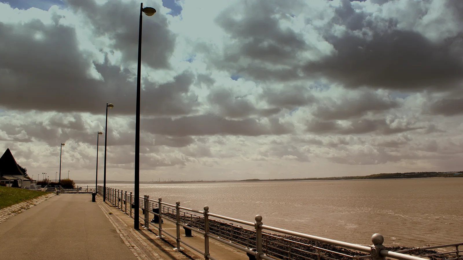
Photo: calflier001 (CC BY-SA 2.0) via Wikimedia Commons
Liverpool City Region Combined Authority wants to take a proposed tidal barrage forward in a corridor between Bromborough in Wirral and Otterspool in south Liverpool. Members are due to consider the preferred location, and a way of financing the project, on Friday 6 November 2026.
The ambition is substantial: a power station with up to 1 gigawatt of generating capacity, designed to operate for 120 years, which could also protect parts of the Mersey estuary from rising sea levels. But the scheme has not received permission to be built or a final investment decision. The precise alignment, cost to customers and effects on wildlife and shipping still need detailed answers.
The Combined Authority announced on 29 October 2026 that the preferred development corridor runs between the Bromborough and Otterspool areas. It describes this as a 1.5-mile stretch of the river taking in both banks.
That is a zone in which the scheme could be developed, not confirmation of a 1.5-mile-long finished barrier. The exact points where a structure would meet land, its layout and the space needed for associated works have yet to be settled.
An assessment of possible positions led to the recommendation. The Combined Authority says further engineering should examine how the barrage could work alongside shipping channels, including channels beside the structure and options using locks. Neither arrangement has been selected as the final answer.
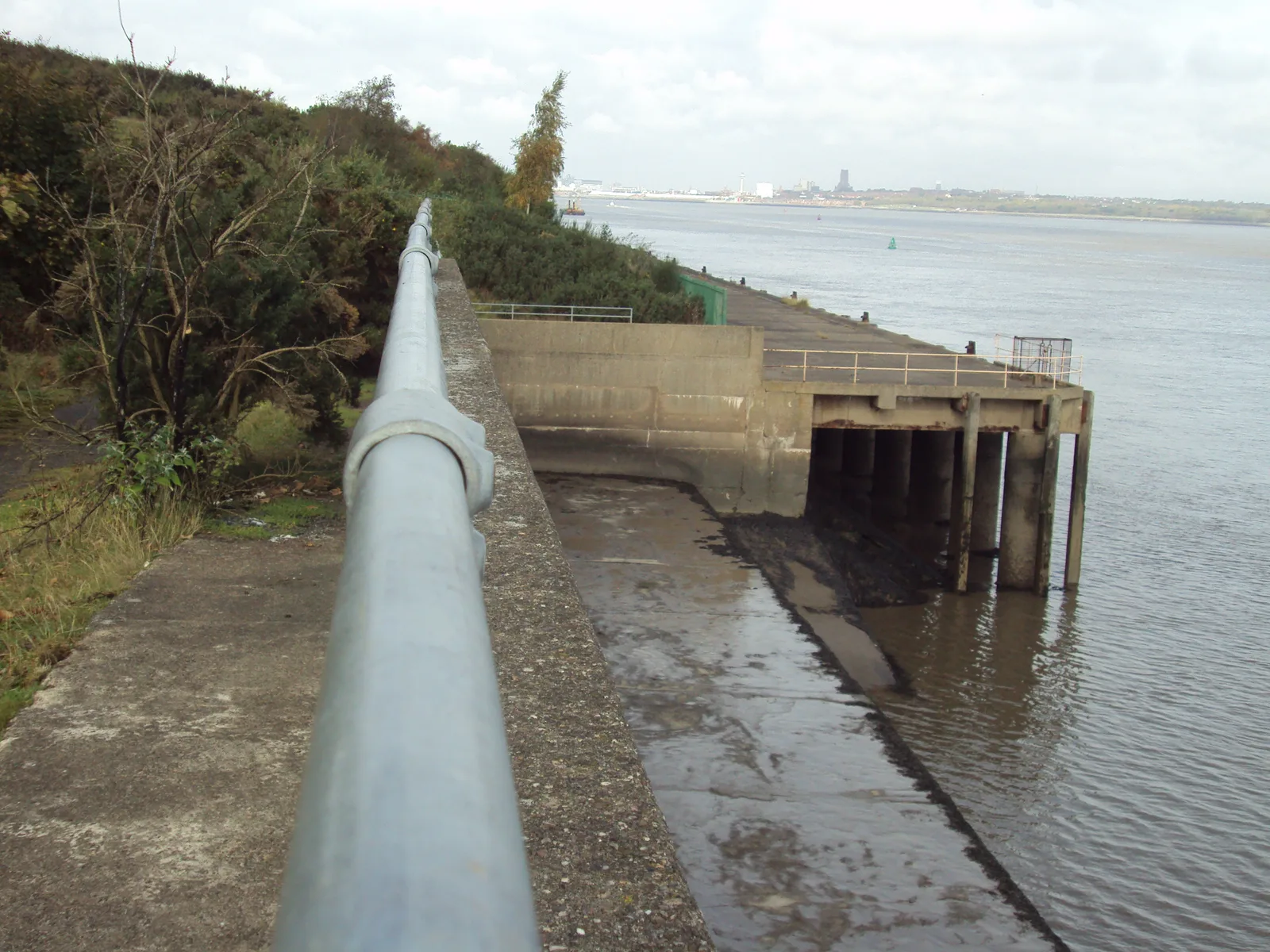
The Mersey at Bromborough on the Wirral bank, the western end of the preferred corridor. No alignment or shore landing point has been fixed. Photo: Rept0n1x (CC BY-SA 3.0) via Wikimedia Commons.
For people around Otterspool, Bromborough and the wider estuary, the unanswered details include the actual shore connections, construction access, any electricity cables and the effect of altered water levels. The official announcement includes a proposed corridor map, but it should not be read as a final construction plan.
What happens on 6 November?
The Combined Authority's forward decision notice lists Mersey Tidal Power Update as a key decision due on 6 November. The authority's 29 October announcement says members will be asked to endorse two preferred approaches:
The Bromborough to Otterspool alignment corridor for further design and assessment.
A Regulated Asset Base (RAB) model as the preferred approach to funding.
Approval would allow further engineering, environmental and commercial development ahead of an application for a Development Consent Order (DCO). This is the national infrastructure planning permission the project would need. It would not approve the construction, fix the final route or mean finance has been secured.
As of 31 October, the forward decision notice is public but the full agenda report, the underlying Barrage Scheme Options Appraisal and the completed Finance Model Update have not been published. The recommendations, assumptions and financial figures in those papers are the detail to read when they appear.
A tidal-range barrage uses the difference in water height on either side of a barrier. Gates control water moving with the tides and turbines turn some of that movement into electricity. The proposal includes turbines, sluice gates, arrangements for ships, electricity export infrastructure and facilities on land. The Combined Authority's consultation material describes those components.
The authority says the Mersey has a tidal range of up to 10 metres and believes a finished scheme could reach 1GW of generating capacity. That figure describes the proposed maximum output, not electricity supplied continuously, 24 hours a day. Annual production, operating pattern and performance assumptions need to be set out in the final business case.
The ambition for 120 years of operation does not mean every part would last for 120 years unchanged. The Planning Inspectorate's 2024 scoping opinion notes that some components could require major maintenance or replacement on much shorter cycles, around 12 to 20 years in the early design assumptions. Future assessments must account for that.
Who would pay, and could it affect electricity bills?
The Combined Authority's preferred financing approach is a Regulated Asset Base, usually shortened to RAB. Instead of relying entirely on investors to fund years of construction before earning anything, a regulated project can start recovering an agreed portion of its costs during construction.
That can lower borrowing costs and make a long-lived project more attractive to investors. It also changes who carries the risk. If the project becomes more expensive or takes longer than planned, the design of the regulation determines how much of the extra cost falls on investors, customers or taxpayers.
There is an established nuclear example. The UK Government's explanation of the Nuclear Energy (Financing) Act 2022 says that under the nuclear RAB model charges go through electricity suppliers and are expected ultimately to reach customers' bills. That is an example of how a RAB can work, not proof that an identical levy has been authorised for Mersey tidal. The legal and commercial arrangements for this scheme are not yet settled.
It is also important not to confuse construction cost, financing cost and total consumer cost. They are different measures. The October announcement does not give a verified final capital cost, a projected household bill impact or a signed package of public and private investment.
A National Energy System Operator study published in October 2025 adds useful context. It found potential benefits from predictable tidal power and lower wholesale prices, but its modelling also found that the no-tidal scenario was the cheapest overall among the scenarios it tested. RAB financing narrowed the difference while passing additional development and construction risk to consumers.
Crucially, NESO modelled hypothetical tidal schemes, not the proposed Mersey barrage's own design. Its figures cannot be presented as the cost of this project. The study makes the case for publishing Mersey-specific numbers before anyone claims that the finance model offers good value.
The questions for the next financial report are straightforward: How much would it cost to build? How much could customers pay before power is produced? Who pays for an overrun? What public guarantee or subsidy is required? And which alternatives were compared?
Free weekend guide every Thursday
Things to do, useful local news and our latest Liverpool guides. Free to your inbox.
The environmental questions that have not gone away
The Mersey estuary is not an empty stretch of water. Its mudflats, saltmarshes and shorelines support feeding and wintering birds, fish and other wildlife. The Mersey Estuary and the Mersey Narrows and North Wirral Foreshore have internationally protected habitats. The Wildlife Trust for Lancashire, Manchester and North Merseyside has raised concerns that changing tidal patterns could alter the habitats on which birds and other species depend.
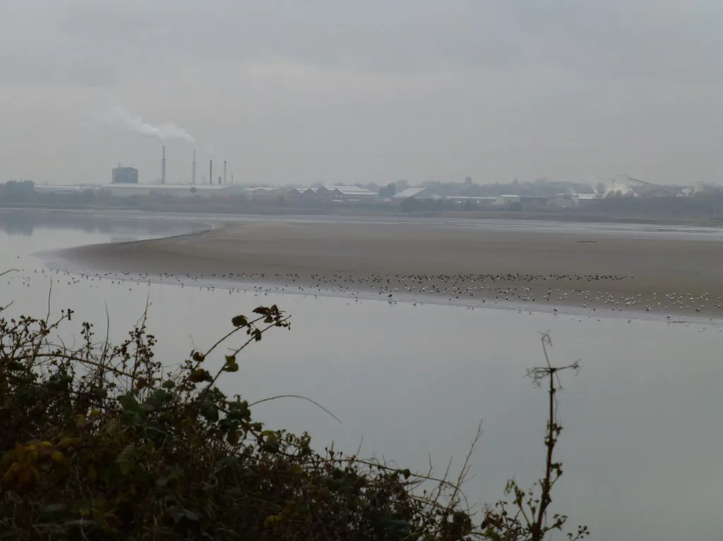
Birds feeding on exposed mudflats in the Mersey estuary. How long mudflats stay uncovered is one of the questions a barrage assessment has to answer. Photo: Raymond Knapman (CC BY-SA 2.0) via Wikimedia Commons.
A barrage could change how high water rises, how long mudflats stay covered, how sediment moves and how fish pass through the estuary. The size and seriousness of those effects will depend on the final design and how it is operated. They cannot be determined from the newly selected corridor alone.
The concerns are concrete, not simply opposition to renewable energy. In its consultation response summary, Wirral Wildlife asks for assessment of disturbed contaminated sediments, effects on fish and birds, the construction's carbon footprint, changes along the Sefton coast and the Dee, and whether replacement habitat would be ready before any damage occurred.
There are also questions for businesses and river users. The Planning Inspectorate's October 2024 scoping opinion requires the developing assessment to address issues including navigation, dredging and disposal of potentially contaminated sediment. Responses reproduced in that opinion raise possible effects on Liverpool's South Docks, including altered silt deposition and salinity. Water quality in the river has improved a long way since the 1980s, as our guide to whether you can swim in the River Mersey sets out, and campaigners want that progress protected.
None of that proves the scheme cannot be built. It shows why a planning application must explain impacts, alternatives, mitigation and, where legally required, compensation in enough detail to be tested independently.
Could the barrage protect homes from flooding?
Flood protection has become a core objective alongside renewable electricity. In January 2026, the Combined Authority said work using updated Environment Agency flood maps strengthened the case for a barrier that could manage water levels as seas rise.
A barrier may be able to reduce certain tidal flood risks upstream. But a river system is more complicated than a wall keeping the sea out. The project must also assess river flows, drainage, tributaries and whether changing water levels could shift a problem elsewhere.
The Environment Agency's response included in the 2024 scoping opinion calls for assessment beyond the immediate barrage site, upstream towards tidal limits, and warns against overlooking changes to local flood levels during construction. The authority's proposed flood benefit is therefore a claim to be demonstrated through modelling and assessment, not a protection guarantee for individual properties today.
Is the promised timetable still realistic?
The latest 29 October 2026 announcement says a Final Investment Decision is now expected in 2030. A further round of public engagement is being planned for late 2027 or early 2028.
There has already been slippage. The 2024 public consultation website still describes earlier aspirations for a 2026 planning submission and a 2028 decision, but that timetable is outdated. A February 2026 scrutiny report said the anticipated development funding and revenue-model support from central government had not arrived, with a full business case potentially reaching the early 2030s and delivery in the late 2030s.
Those dated statements are not a single firm timetable. The next official report needs to explain how the proposed 2030 investment decision aligns with the earlier assessment of work still to be done. No construction start or opening date can be treated as confirmed.
What Liverpool and Wirral residents should look for next
For now, the decision is about which corridor to investigate and how the project might be financed, not whether a barrage should be built at any cost. The evidence still needed is the exact design and landings, a project-specific financial comparison, a tested flood-risk case, detailed environmental assessments and workable access for shipping.
The immediate test on 6 November is whether members endorse the two preferred approaches, and exactly what conditions and further work accompany that decision. The webcast starts at 1pm.
Mersey tidal barrage: the source documents
All checked 31 October 2026 unless a publication date is stated.
Wirral Council has approved £800,000 for Duke Street in Birkenhead. It pays for designs, not building work, which is put at £3m to £8m and not yet funded.
Forty years after Diane Sindall was murdered in Birkenhead, DNA cleared Peter Sullivan. Police are still trying to identify the man behind the profile.
The Combined Authority's preferred development corridor runs between Bromborough in Wirral and Otterspool in south Liverpool, described as a 1.5-mile stretch of the river taking in both banks. That is a zone to investigate, not a fixed alignment. The exact shore landing points have not been settled.
What is being decided on 6 November 2026?
Members are asked to endorse two preferred approaches: the Bromborough to Otterspool corridor for further design and assessment, and a Regulated Asset Base model as the preferred funding route. It would not approve construction, fix the final route or confirm that finance is secured.
Would the Mersey barrage put money on my electricity bill?
No bill impact has been published for this scheme. Under the nuclear Regulated Asset Base model, charges go through electricity suppliers and are expected to reach customers' bills, but the legal and commercial arrangements for Mersey tidal are not yet settled and no household figure has been produced.
How much electricity would the Mersey barrage produce?
The Combined Authority believes a finished scheme could reach 1 gigawatt of generating capacity. That is a proposed maximum output, not continuous supply. Annual production and operating pattern still have to be set out in the final business case.
When would the Mersey barrage be built?
No construction start or opening date is confirmed. The 29 October 2026 announcement expects a Final Investment Decision in 2030, with further public engagement in late 2027 or early 2028. A February 2026 scrutiny report pointed to a full business case in the early 2030s and delivery in the late 2030s.
Comments
Join the conversation with your L1Local Community account. Keep it civil and on topic.

Comments
Join the conversation with your L1Local Community account. Keep it civil and on topic.