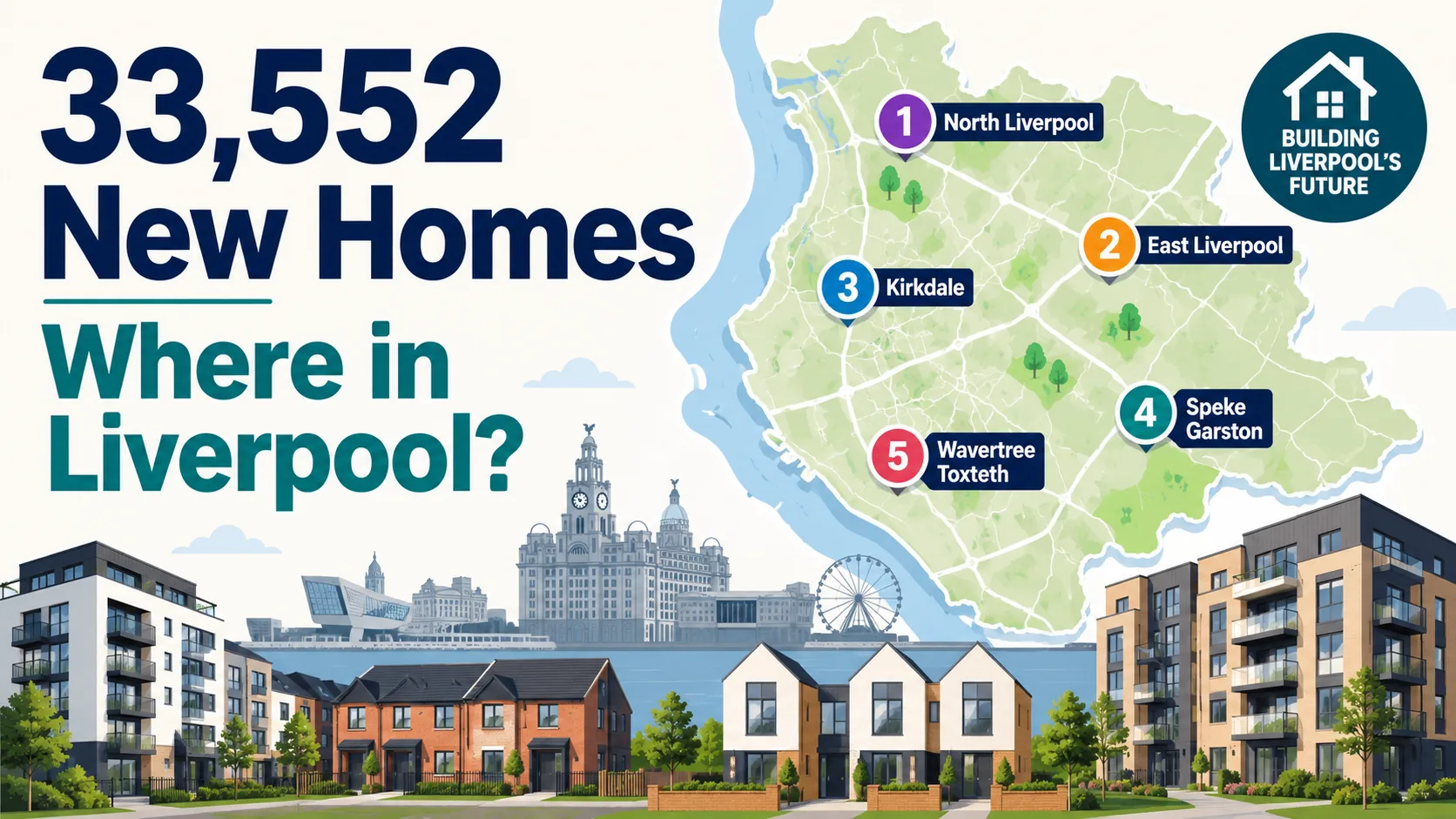
Liverpool City Council says its new Local Plan could provide space for more than 33,500 homes by 2043.

That sounds like a list of fully approved building projects. It is not.

The figure combines homes already completed, developments with planning permission, newly allocated building sites, and thousands of homes expected to appear on sites that have not yet been identified. It's better understood as a long-term planning target than a construction programme.

The short version

  • Liverpool's draft Local Plan provides for roughly 33,500 to 33,750 homes by 2043. The council's announcement and the draft document itself use slightly different figures, and neither has explained the gap.
  • Only 1,494 homes in that total are already built. Another 17,496 have planning permission or a legal agreement, but the council only counts 90% of those as likely to happen.
  • The rest, 11,316 homes, comes from newly allocated sites with no planning permission yet, plus 5,194 homes from "windfall" sites that haven't even been identified.
  • The biggest single allocation is Pumpfields and Limekilns, north of the city centre, at roughly 2,806 homes. The city centre and North Liverpool between them account for most of the total.
  • A Local Plan allocates land and sets policy. It does not grant planning permission, fund infrastructure, or force anyone to build.
  • The plan is at the Regulation 19 stage, meaning it still needs to go through independent examination. Adoption is expected in 2027.

There's a discrepancy in the numbers

The council's announcement says the proposed Local Plan provides for at least 33,552 new homes over the next 17 years.

The Regulation 19 draft of the plan itself uses a requirement of 33,750 homes between 2025 and 2043, based on 1,875 homes a year over 18 years.

The council hasn't explained the 198-home difference between the two figures in its public announcement. Until the documents are aligned, the safest description is that Liverpool is planning for about 33,500 to 33,750 homes by 2043.

Where does the total come from?

The draft plan's calculation is made up of five different sources:

  • 1,494 homes completed between April 2025 and April 2026.
  • 17,496 homes with planning commitments as of April 2026.
  • A 10% reduction applied to those commitments, leaving 15,746 homes, because the council accepts that some approved schemes will never be built.
  • 11,316 homes on newly allocated Local Plan sites.
  • 5,194 homes from future "windfall" sites, meaning developments not currently identified in the plan.

Together, the draft calculation reaches 33,750 homes. About half of the requirement is connected to schemes that already have planning permission or approval subject to legal agreements. Even those homes aren't guaranteed, which is why the council has applied its non-delivery discount.

What does a Local Plan do?

A Local Plan is the council's main rulebook for deciding how land should be used. It identifies land that could be developed for housing, employment, shops and community facilities, and sets policies covering building height, housing mix, affordable housing, transport, open space, heritage, flooding and design.

Once adopted, planning applications are normally expected to follow it unless there are strong reasons to make a different decision.

A Local Plan does not:

  • give every allocated site planning permission;
  • force a landowner to build;
  • guarantee that a developer can secure finance;
  • provide all the money required for roads, schools or utilities;
  • mean construction will begin immediately.

An allocation means the council considers a site suitable in principle. A developer must normally submit a separate planning application dealing with design, access, infrastructure, environmental effects and viability. The draft also says the housing numbers attached to allocations are indicative minimum capacities, with final figures decided through the planning process.

The new plan hasn't been adopted yet. It's at the Regulation 19 pre-submission stage, after which it must be examined by an independent planning inspector. The current timetable suggests adoption could happen in 2027, though objections, examination hearings or required modifications could delay that.

Where would the homes be built?

The official map shows development spread across Liverpool, but the largest concentration would be around the city centre, the northern waterfront and North Liverpool. The plan says the City Centre and City Centre North could accommodate around 17,000 homes by 2043, including homes already approved as well as new allocations.

Map and infographic showing where Liverpool's 33,552 planned new homes would be built, with numbered sites from Pumpfields and Limekilns to Garston and Speke, plus a breakdown of completed, committed, allocated and windfall homes.
Where the numbers come from and where the biggest sites are · L1 Local

1. Pumpfields and Limekilns

Pumpfields and Limekilns is the largest individual housing allocation in the draft plan, with an indicative capacity of 2,806 homes. The area sits between the northern edge of the city centre, Vauxhall and the route towards Everton's new stadium, and currently holds warehouses, industrial businesses, surface parking and vacant land.

The council wants it to become a residential-led mixed-use neighbourhood connecting the city centre with North Liverpool. That needs more than apartment blocks: the plan refers to public transport, active-travel routes, community facilities, utilities and better links between adjoining developments.

2. North Docks and King Edward Street

The North Docks form part of the much larger Liverpool Waters area. The Local Plan supports a new waterfront neighbourhood containing homes, employment space, public areas and cultural or leisure uses. King Edward Street, between the commercial centre and Princes Dock, is also identified as a major redevelopment opportunity.

These areas have substantial long-term capacity, but the Local Plan shouldn't be confused with approval for every building shown in waterfront masterplans. Individual plots will still need viable proposals, detailed permission and infrastructure funding.

3. Ten Streets

Ten Streets covers former dockside and industrial land north of the city centre, around Regent Road and the streets leading towards Bramley-Moore Dock. The plan sees it as part of the northern extension of the city centre, with a mixture of employment, cultural activity and housing.

Its location makes it attractive for regeneration, but it also creates practical problems: existing industrial businesses need protecting or relocating, walking routes are limited, and transport connections would need to improve as the residential population grows.

4. Pall Mall and Moorfields

Vacant and underused land around Pall Mall and Moorfields is identified for high-density city-centre development. The area is close to Moorfields station and the commercial district, making it one of the places where the council expects homes and employment space to be combined.

This is likely to mean apartments rather than suburban houses. The important planning questions will concern housing size, affordability, public space, daylight, building height and pressure on local services.

5. St George's Gateway

The draft allocates the wider St George's Gateway sites for mixed-use development with an indicative capacity of 500 homes. This covers land around the northern approach to the city centre, connecting Lime Street, London Road, Everton and the Knowledge Quarter.

Because it crosses several neighbourhood boundaries, it would need coordinated planning rather than a series of unrelated developments.

6. Central Station, Great George Street and the southern city centre

Several large allocations are concentrated south of the main shopping area:

  • King Dock Street: approximately 903 homes.
  • Parliament Street, Chaloner Street, Greenland Street and Flint Street: approximately 507 homes.
  • Kings Dock: approximately 495 homes.
  • Central Station site: approximately 400 homes.
  • Great George Street: approximately 400 homes.
  • Former Canning Police Station: approximately 240 homes.

These figures are indicative planning capacities, not promises that each development will be built at that size.

7. Baltic Triangle

The Baltic Triangle remains an important location for both city-centre housing and creative or digital businesses. The challenge will be allowing more people to live there without gradually removing the workshops, venues and smaller businesses that made the area valuable in the first place.

The proposed Baltic railway station strengthens the case for development around the area, but new housing would also increase pressure on pavements, crossings, public space, local shops and health services. The Local Plan identifies the new Baltic station and other major stations as places where brownfield land could be used more intensively.

8. Festival Gardens

The former International Garden Festival site is allocated for approximately 800 homes. Unlike many city-centre allocations, the council describes Festival Gardens as a new neighbourhood rather than a collection of individual apartment schemes, calling for different housing types and tenures, public space, community facilities, retail provision and links with surrounding neighbourhoods.

The site covers about 10.79 hectares, with approximately 7.97 hectares available for development following remediation work. The condition of the land and the cost of preparing it have been major issues for years, making enabling work particularly important here.

Nearby Brunswick Business Park is separately allocated for employment-led mixed use with an indicative housing capacity of 750 homes. That's not the same site as the former Garden Festival land, even though both sit within the wider southern waterfront area.

9. Dingle and the Mill Street corridor

The plan identifies a cluster of smaller and medium-sized sites around Mill Street, Park Road, Harlow Street and surrounding parts of Dingle, including:

  • land and buildings around Stanhope Street and Mill Street, approximately 210 homes;
  • ADM Milling on Mill Street, approximately 63 homes;
  • land off Grafton Street, approximately 110 homes;
  • the former James Troop site on Sefton Street, approximately 99 homes;
  • a number of smaller cleared, former industrial and infill sites.

This area shows how the total wouldn't be delivered only through a handful of major developments. Dozens of smaller brownfield sites are included across existing neighbourhoods.

10. North Liverpool neighbourhoods

Outside the city-centre boundary, the plan identifies regeneration opportunities across Vauxhall, Everton, Kirkdale, Anfield, County, Walton, Fazakerley and Croxteth.

Named proposals include housing around Great Homer Street and Scotland Road, smaller sites throughout Everton and Vauxhall, approximately 304 homes at Aintree Hospital, and more than 200 homes as part of an employment-led development at Stonebridge Cross.

The plan also supports housing renewal around County Road and Breck Road, and expects Liverpool and Everton football clubs to act as catalysts for surrounding regeneration. That's a strategic ambition, not a commitment by either club to deliver a fixed number of homes.

11. Garston, Speke and the southern suburbs

Further allocations are spread across Garston, Speke, Mossley Hill, Aigburth and surrounding districts. Larger examples include:

  • 250 homes on land at Banks Road in Garston;
  • 250 homes at the former IM Marsh campus;
  • smaller sites around Stapleton Avenue, South Parade, Alderfield Drive and Clough Road in Speke;
  • approximately 50 homes at Liverpool Hope University's Aigburth campus;
  • several smaller sites in Garston and Mossley Hill.

These are mostly more modest allocations than those around the city centre, but together they contribute to the citywide housing supply.

12. East Liverpool and existing neighbourhoods

Smaller allocations also appear in Kensington and Fairfield, Old Swan, Edge Hill, Wavertree, Stoneycroft, Princes Park and Allerton, including the former Valeo food factory on Edge Lane, the former fruit and vegetable market site in Old Swan, land north of Thingwall Road and smaller infill plots around West Derby Road.

The overall approach is to prioritise previously developed land rather than release large areas of Liverpool's remaining green space.

What infrastructure would be required?

Building the homes is only part of the job. The Local Plan says development must be supported by physical, social and green infrastructure.

Public transport and local connections

The largest growth areas would need better bus services, safer walking and cycling routes, improved crossings and stronger links to railway stations. The plan identifies Sandhills, Moorfields, Central, the proposed Baltic station, Brunswick and Liverpool South Parkway as important transport nodes around which development could be concentrated. North Liverpool proposals also refer to mobility hubs and better access to the Leeds and Liverpool Canal.

Electricity and other utilities

The northern growth area would need major utility investment. The draft specifically identifies the need for a new 132kV electricity grid connection, with the council and ScottishPower Energy Networks working to identify and safeguard a suitable location. Electricity capacity matters more as buildings, heating and transport move away from fossil fuels; new developments may also need water, wastewater, drainage, telecommunications, heat-network and energy-storage infrastructure.

Schools and childcare

Large family-housing developments can create demand for nursery, primary and secondary school places. Some needs may be met by expanding existing schools; larger growth areas could require new facilities or land reserved for future education use. An allocation doesn't mean a school has already been funded. The requirement, location, timing and payment arrangements would normally be settled as development proposals become more detailed.

GP surgeries and healthcare

Thousands of additional residents would increase pressure on GP practices, pharmacies, dentists, community care and hospital services. The plan says the scale and distribution of new primary healthcare facilities will be informed by the Infrastructure Delivery Plan and discussions with the NHS, and identifies possible enhanced healthcare provision alongside development at Aintree Hospital.

Parks, play areas and public space

Higher-density housing needs accessible outdoor space: parks, play areas, sports facilities, trees, landscaped streets and routes connecting neighbourhoods with the waterfront or canal. Festival Gardens already has an important parkland and waterfront setting, so development there would have to show how housing can be introduced without treating the remaining landscape as spare building land.

Flood protection and drainage

Waterfront and former dockland sites can require flood-risk work, drainage systems, raised building levels and careful management of surface water. Brownfield sites may also need contaminated land treatment before housing can be safely built. These costs can determine whether a development is financially viable.

Shops and community facilities

A development of several thousand homes can't rely entirely on existing city-centre facilities. Areas such as Pumpfields, North Docks and Festival Gardens would need everyday services, including food shops, childcare, community rooms, safe public spaces and places where residents can access support.

Who would pay for the infrastructure?

The Local Plan says developers may be required to provide infrastructure directly or contribute through planning agreements and the Community Infrastructure Levy. Utility companies, the council, the Combined Authority, the NHS, government departments and other public bodies may also be involved.

The Infrastructure Delivery Plan is described as a live document. The timing of projects depends on funding, development phasing, feasibility work and, in some cases, separate planning permission.

In plain English: the Local Plan can require developers to deal with the effects of their schemes, but it can't guarantee that every major road, school, station or health facility is already funded.

Confirmed plans versus long-term ambitions

Already built

The draft counts 1,494 homes completed between April 2025 and April 2026. These are the only homes in the calculation that are unquestionably delivered.

Approved or committed

A further 17,496 homes had planning permission or approval subject to a legal agreement in April 2026. These are more advanced than Local Plan allocations, but planning permission doesn't guarantee construction. Developers can delay projects, sell sites, change designs or allow permission to expire, which is why the council counts only 90% of these homes in its supply calculation.

Proposed allocations

The 11,316 homes on newly allocated sites are proposals within the draft Local Plan. They don't yet have automatic planning permission. Some may already be connected to active development proposals, while others may remain unused for years.

Unidentified future sites

The plan assumes 5,194 homes will come from windfall developments: sites not currently on the named allocation list. These might include redundant commercial buildings, cleared land, conversions and smaller infill developments that emerge before 2043.

Wider ambitions

Ideas such as intensifying land around Sandhills station, creating complete new waterfront neighbourhoods and exceeding the minimum housing requirement are long-term ambitions. They set a direction for future decisions, not the same thing as funded projects with contractors and start dates.

The bottom line

Liverpool isn't about to start building 33,552 homes under one council-run programme. The proposed Local Plan is creating a pipeline of land and policies that could allow roughly that number of homes to be delivered by 2043.

The largest concentration would be around the city centre, North Docks, Ten Streets, Pumpfields and Limekilns, Pall Mall and North Liverpool, with a separate new neighbourhood proposed at Festival Gardens. Smaller developments would be spread through Dingle, Garston, Speke, Everton, Vauxhall, Kensington, Old Swan, Wavertree and other existing communities.

The real test won't be how many homes appear on a planning map. It'll be how many break ground, how many are affordable or suitable for families, and whether schools, health services, transport, utilities and public spaces arrive at the same time.

Sources

The draft Local Plan's detailed housing breakdown (the completed, committed, allocated and windfall figures, and individual site capacities) comes from the Regulation 19 draft document itself. The council's own summary figure differs slightly from the draft's, as explained above. This article will be updated if that's clarified or if the numbers change during examination.